Forecast issued at: Monday 02nd March 2026 12:00
Rain
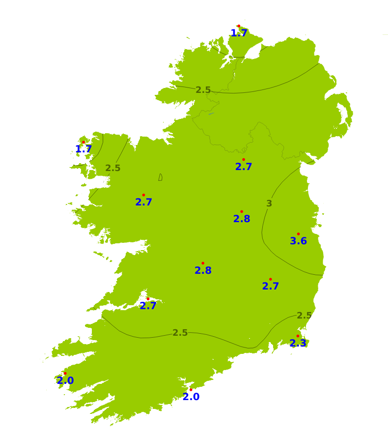
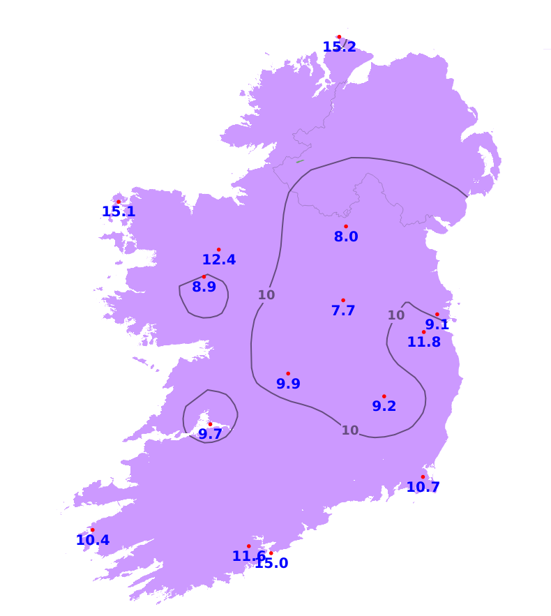
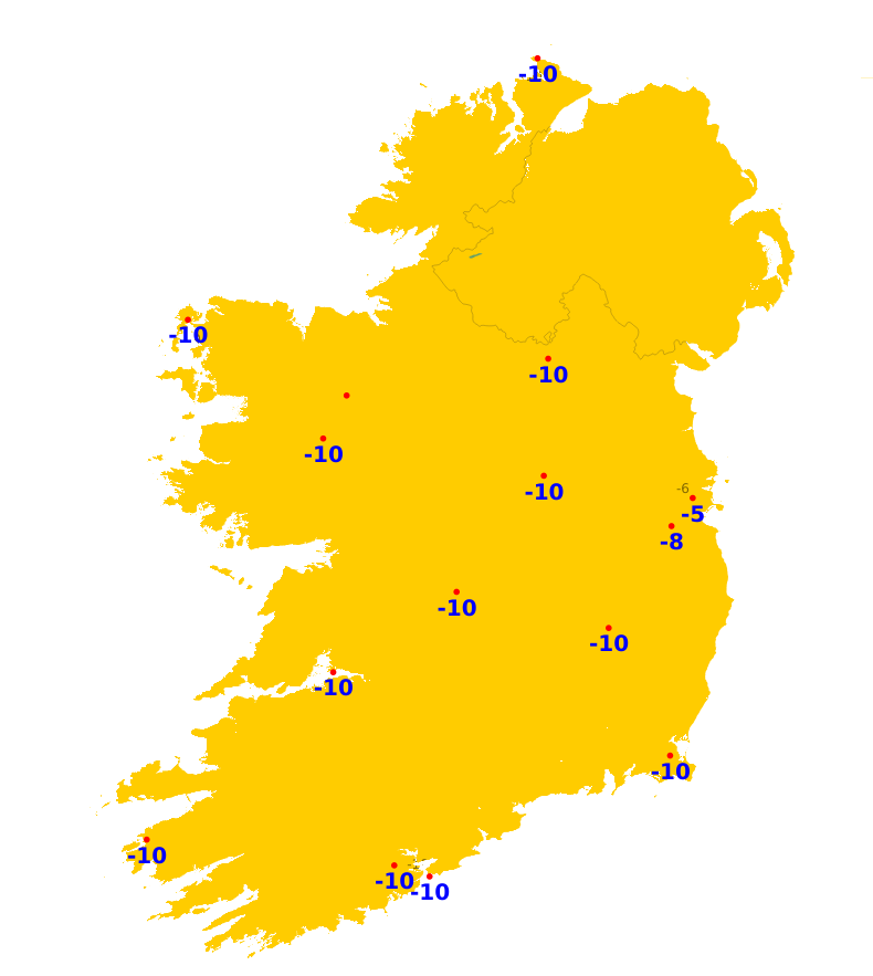
Over the past week, rainfall amounts were close to or above average for most areas, with the exception of eastern coasts. Accumulations ranged between 47% of average in the east and 178% of average in the southwest. Just 5.7mm of rainfall was recorded at Dublin Airport while 52.8mm was recorded at Valentia Observatory, Co. Kerry. In the week ahead, there will be occasional spells of rain but it will be largely settled. Rainfall amounts will below average for most of the country as a result, though will be closer to average in some western and midland areas.
Temperatures
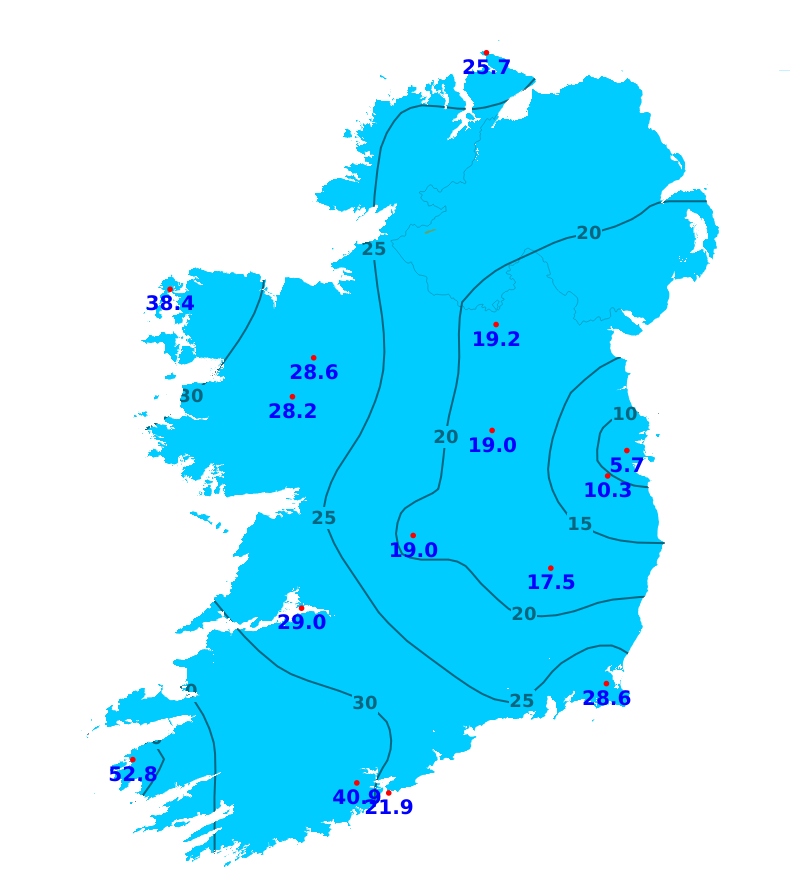
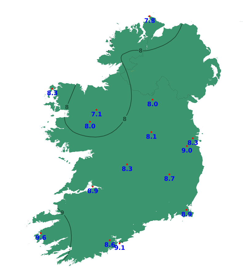
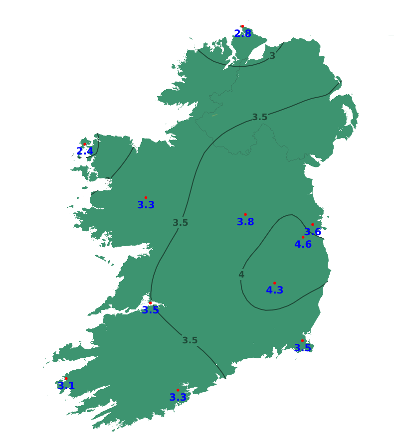
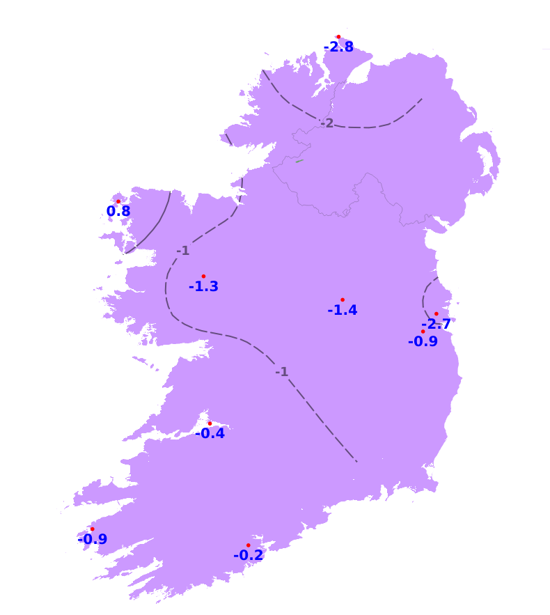
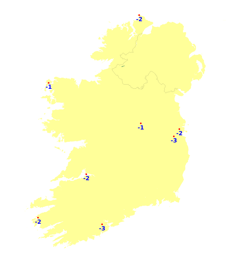
It was milder than average nationwide over the past week, with mean air temperatures ranging from 7.9 to 9.6 degrees, which is between 1.7 and 3.6 degrees above average. Mean soil temperatures were also above average in all areas, ranging between 7.1 and 9.6 degrees, which is 2.4 to 4.6 degrees above average. There will be some cooler interludes in the week ahead, with occasional nighttime frosts possible. Mean air temperatures will fall back to between average and 2 degrees above. Mean soil temperatures will remain above average.
Sunshine
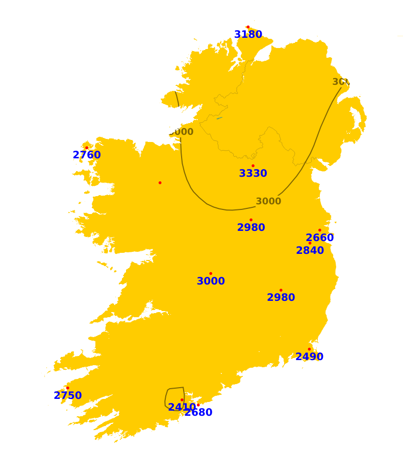
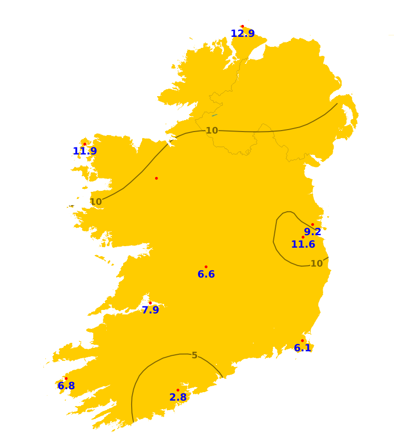
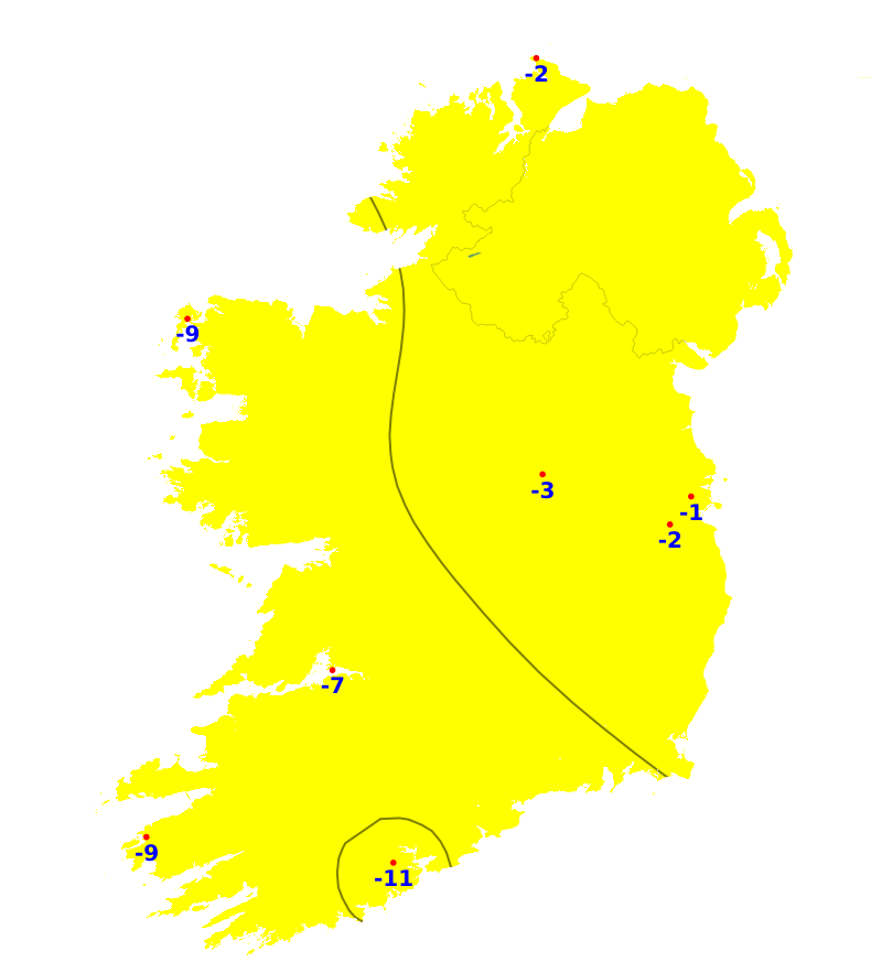
Over the past week, sunshine amounts have been below average, ranging between 14% and 69% of normal. It was brightest in northern areas with 12.9 hours of sunshine recorded at Malin Head, Co. Donegal. The south was the dullest region with just 2.8 hours of sunshine recorded at Cork Airport. More settled conditions and sunny spells in the coming week will result in above average sunshine amounts, with the highest amounts likely in eastern areas.
Drying Conditions
Drying conditions will improvein the week ahead. There will be spells of rain at times from later on Wednesday and on Thursday with poor drying for a time. However, drying will improve again thereafter.
Spraying
There will be opportunities for spraying at times early this week with drier conditions and light winds. Moderate to fresh winds will develop through Wednesday which may hinder spraying with rain on Thursday also limiting spraying opportunities for a time. There will be further opportunities from Friday on.
Field Conditions
At present, most soils are saturated with moderately drained soils in the south and west and all poorly drained soils waterlogged. Field conditions and trafficability will improve during the week ahead. Soil moisture deficits in well and moderately drained soils will increase slightly, though some moderately drained soils will remain saturated. Poorly drained soils will remain saturated or waterlogged.
Forecast maps and meteograms can be found on Blight Forecast.