Réamhaisnéis limistear na farraige
Forecast valid from: 06:00, Saturday 14 February 2026 until 06:00, Sunday 15 February 2026
Small Craft Warning
Southerly winds will reach force 6 or higher today (Saturday) on all Irish coasts.
Gale Warning
Southerly winds will reach gale force 8 or strong gale force 9 at times today (Saturday) and tonight on all Irish coastal waters and on the Irish Sea.
Atlantic Swell
At times for western and northwestern coasts later Saturday.
Meteorological Situation at 03:00 UTC
A ridge of high pressure lies over Ireland, generating a mostly light to moderate variable airflow. A strengthening southerly flow will develop as the ridge declines and frontal troughs associated with a developing depression of 986hPa, centred in the mid-Atlantic, track eastwards over the country.
Gale Warning: In effect
Small Craft Warning: In effect
Heavy Swell (>4m) : yes
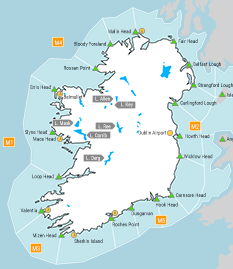
Forecast for Mizen Head to Slyne Head to Malin Head
Wind: Increasing southerly force 6 or 7 and gusty imminent. Soon increasing force 7 to strong gale force 9, strongest in the northwest. Later decreasing west or southwest mainly force 5 or 6 and gusty.
Weather: Cloudy imminent with rain extending eastwards, heavy at times. Scattered showers later with a chance of hail and isolated thunderstorms. Possible outbreaks of rain in the southwest by the end of the period.
Visibility: Moderate or poor in precipitation.
Forecast for Malin Head to Wicklow Head to Mizen Head and for the Irish Sea
Wind: Variable force 2 to 4. Soon increasing southerly force 6 or 7 and gusty. Later increasing force 7 or gale force 8 and gusty. Decreasing southwesterly mainly force 4 to 6 by the end of the period.
Weather: Mostly fair with isolated showers. Cloudy soon with rain extending eastwards, heavy at times. Scattered showers in the north and east by the end of the period.
Visibility: Mostly good at first, decreasing moderate or poor in precipitation.
Outlook for a further 24 hours until 06:00, Monday 16 February 2026
Moderate to strong and gusty westerly winds increasing mostly strong to near gale force through Sunday, reaching gale force at times, especially in the southwest. Weather: Rain in the south and southeast at first, clearing to scattered blustery showers with a chance of hail and thunderstorms.
Forecast issued at: 06:00, Saturday 14 February 2026
All times are local unless specified